Posted By: Jerry XT
Continental Divide....Chapter 2 - 09/27/07 07:22 PM
Continental Divide….Chapter 2
After wimping out on Monday due to freezing temperatures and intimidating streams I mounted up Tuesday better prepared. Thermal underwear top to bottom….socks, long johns, light and expedition upper, head hood, and glove liners! I also brought my fishing hip waders for the occasional stream.
The plan was to head south from Buena Vista (BV), west up to old mining town St. Elmo, over Tin Cup pass (Continental Divide-CD) to old mining town Tin Cup, north on Timberline Trail to Cottonwood Pass Rd, then back over CD to BV. Round trip was 87 miles and over the CD twice. It took 7 hours.
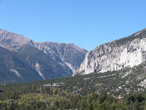
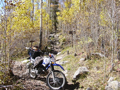
Chalk Creek Canyon to St. Elmo. Gateway to Fun!
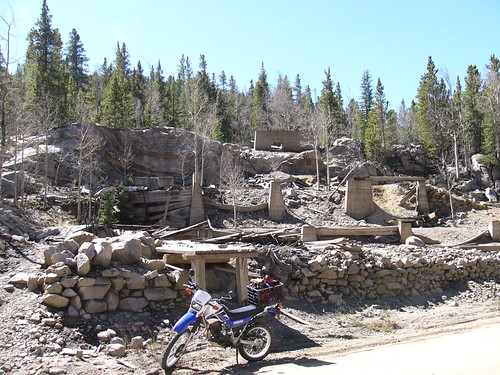
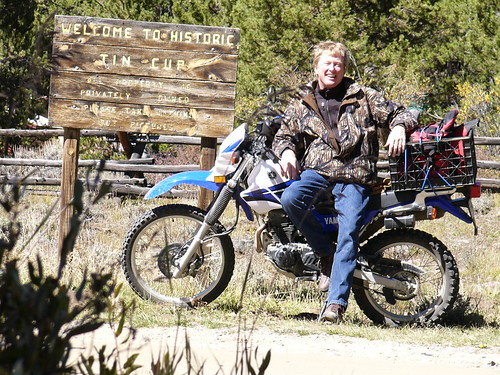
St. Elmo, 1880 Gold and Silver mining town.
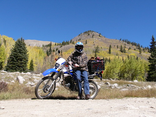
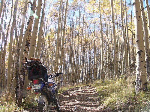
Tin Cup Pass East Aspens
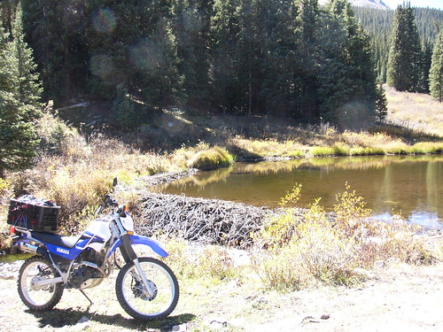
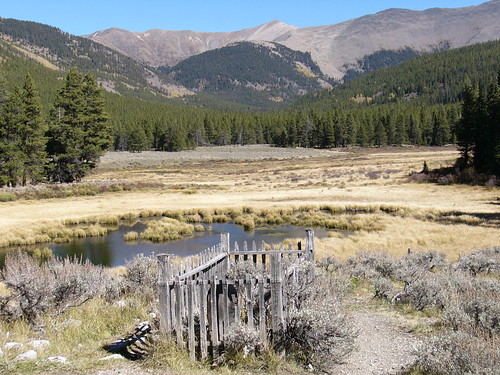
Tin Cup Pass Beaver Ponds
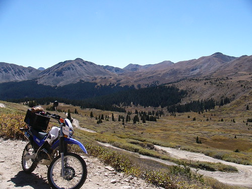
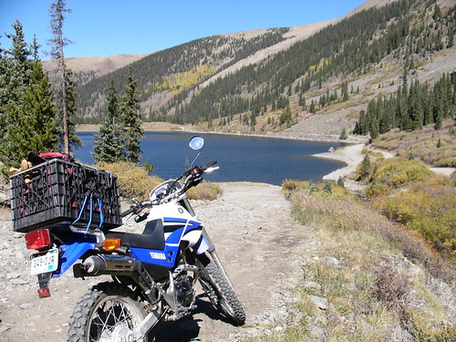
Tin Cup Pass Tree Line
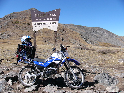
And Finally……..Tin Cup Pass
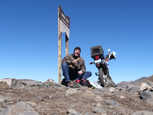
Lunch on the Conintenal Divide. View while humming the Jimmy Buffett song “I wish lunch could last forever”, then “Incommunicado”.
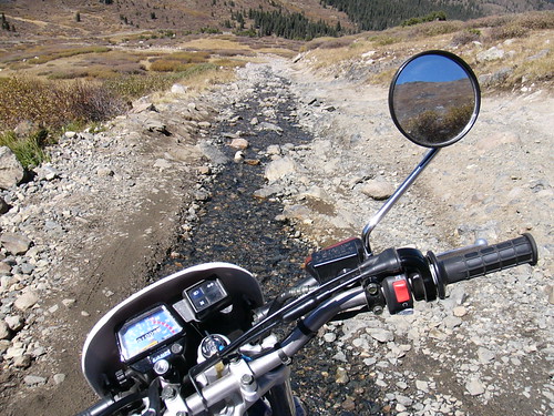
Going Down……..lots of streams that follow the trail for a while. Fortunately not big ones………yet!
Mirror Lake. Dang, I knew I forgot something…….my fly rod!
And finally, Tin Cup. Originally settled by the Ute Indians, later in the 1850’s by prospectors searching for gold. Tin Cup got its name from a prospector who used to carry his gold dust out in a tin cup.
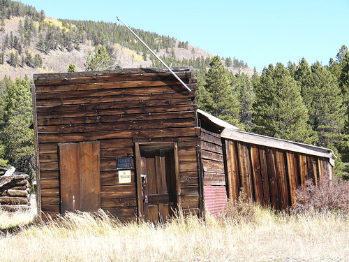
Tin Cup building…
Tin Cup Cemetery. I usually don’t envy the dead but this spirit has quite a plot!
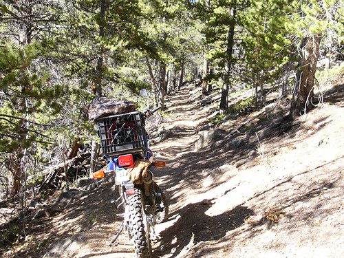
Timberline Trail. There were many boulder fields. It was all I could do to not conk out, not fall over, and not get stuck but I did conk out, fall over, and get stuck many times. The pictures don’t do justice for the difficulty.
Timberline Trail Aspens, a little after the peak color change.
Timberline Trail, note the slope left to right, don’t get off the trail!
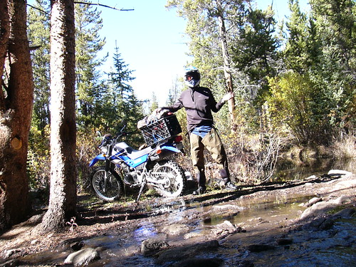
And then the anticipated stream crossing. Actually his stream followed the trail for about 50 feet and was a little over a foot deep. Here I’m suited up for the crossing!
The End! Cheated death again!
Ps: this is a recruiting effort, hoping I can suck a few of my friends into buying a dirt bike going along!
Have Fun!
Jerry
[image]
After wimping out on Monday due to freezing temperatures and intimidating streams I mounted up Tuesday better prepared. Thermal underwear top to bottom….socks, long johns, light and expedition upper, head hood, and glove liners! I also brought my fishing hip waders for the occasional stream.
The plan was to head south from Buena Vista (BV), west up to old mining town St. Elmo, over Tin Cup pass (Continental Divide-CD) to old mining town Tin Cup, north on Timberline Trail to Cottonwood Pass Rd, then back over CD to BV. Round trip was 87 miles and over the CD twice. It took 7 hours.
Chalk Creek Canyon to St. Elmo. Gateway to Fun!
St. Elmo, 1880 Gold and Silver mining town.
Tin Cup Pass East Aspens
Tin Cup Pass Beaver Ponds
Tin Cup Pass Tree Line
And Finally……..Tin Cup Pass
Lunch on the Conintenal Divide. View while humming the Jimmy Buffett song “I wish lunch could last forever”, then “Incommunicado”.
Going Down……..lots of streams that follow the trail for a while. Fortunately not big ones………yet!
Mirror Lake. Dang, I knew I forgot something…….my fly rod!
And finally, Tin Cup. Originally settled by the Ute Indians, later in the 1850’s by prospectors searching for gold. Tin Cup got its name from a prospector who used to carry his gold dust out in a tin cup.
Tin Cup building…
Tin Cup Cemetery. I usually don’t envy the dead but this spirit has quite a plot!
Timberline Trail. There were many boulder fields. It was all I could do to not conk out, not fall over, and not get stuck but I did conk out, fall over, and get stuck many times. The pictures don’t do justice for the difficulty.
Timberline Trail Aspens, a little after the peak color change.
Timberline Trail, note the slope left to right, don’t get off the trail!
And then the anticipated stream crossing. Actually his stream followed the trail for about 50 feet and was a little over a foot deep. Here I’m suited up for the crossing!
The End! Cheated death again!
Ps: this is a recruiting effort, hoping I can suck a few of my friends into buying a dirt bike going along!
Have Fun!
Jerry
[image]

